Low temperature
Impact of mining activities on groundwater quality: the case of the Monte Tondo gypsum quarry (Emilia Romagna, Northern Italy)
Partners: University of Pavia, Saint-Gobain Gyprock Italia
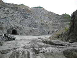
Gypsum karsts aquifers, due to their high flow rates and lack of self-epuring capacity are highly vulnerable to all kinds of pollutants, such as civil waste, quarry and chemical fertilizers. In this case study, we evaluated the impact of mining activities on groundwater quality. A surface and hypogeal structural survey was conducted to understand the tectonic hydraulic natural barriers and ground water flow in the preserved gypsum deposit of the NE hydrological basin; in particular, five fracture systems and the evaporitic layering represent the preferential way for rain water infiltration. On the other hand, the three major fault systems constitute natural barriers to groundwater flow, creating confined or semi-confined aquifers. Water chemistry in the quarry environment is constrained by gypsum dissolution processes and groundwater can be classified as calcium-sulphate. Deeper groundwater sampled in the well in tunnel 200 m (borehole, S2/PZ2) is instead characterised by a sodium-chloride composition with high salinity and hydrocarbon association. This particular case is probably related to a confined salt relict aquifer, trapped by tectonic features. Surface waters samples reveal the contribution of both water types; during the dry season Na-Cl waters dominate. Stable isotopes of the water molecule confirm the presence of different isolated aquifers and restricted groundwater circulation. Publications: MARGUTTI R. (2009) - The gypsum mining area in the “Vena del Gesso” biodiversity landscapes (Monte Tondo quarry, Emilia-Romagna Region): quarrying and old mine tunnels environment impact on natural karsts systems and groundwater quality. Scientifica Acta 3, No. 2, 31 – 37. |
High temperature
Tectonically related fluid circulation in the San Casciano dei Bagni - Sarteano area (M. Cetona Ridge - Southern Tuscany): a coupled structural and geochemical investigation
Partners: University of Pavia, University of Torino
The aim of this investigation is to examine the relationship between springs and structural setting of Mt. Cetona Ridge. This area represents an important regional morpho-tectonic feature oriented NNW-SSE, separated from the geothermal area of Monte Amiata to the West by the Radicofani Neogene Basin, while bound to the East by Valdichiana Neogene-Quaternary Basin. This Ridge is constituted by the Tuscan Nappe and the overthrusted S.Fiora Unit. A new detailed field mapping and structural study allowed recognising a polyphase structural setting defined by four plicative followed by three extensional and transtensional phases. Coupled to the structural investigation, 13 spring water samples were collected in the area in May and in August 2005. Groundwater ranges from cold, low mineralized calcium-bicarbonate to warm, highly mineralised, calcium sulphate. Results are in general agreement with previous studies indicating the recharge area in the Cetona relief and a circulation in a highly fractured, quasicontinuous reservoir constituted by the Mesozoic limestone and the underlying Burano anhydrite formation. Nevertheless, geochemical modelling indicates that the high variability in the hydrochemical and isotopic composition cannot be explained by simple binary mixing between two groundwater types nor by a geochemical evolution involving gypsum dissolution and calcite precipitation. Outflows are closely related to the structural setting of the area and hydrochemistry allows discriminating different fluids associated with specific hydrogeological circuits. The interpretation of the structural setting for Mt. Cetona Ridge was obtained by fieldwork studies integrating geochemical data of both thermal and cold springs. Results of this investigation allow to propose for this area a new tectonic evolution and fluid circulation model. Publications: PISCOPO D., GATTIGLIO M., SACCHI E., DESTEFANIS E. (2009) - Tectonically-related fluid circulation in the San Casciano dei Bagni - Sarteano area (M. Cetona Ridge - Southern Tuscany): a coupled structural and geochemical investigation. Ital.J.Geosci. (Boll.Soc.Geol.It.), 128/2, 575-585, DOI : 10.3301/IJG.2009.128.2.575 |
| Elisa Sacchi |
|
